Tanana River and Big Delta airborne magnetic and radiometric survey

Posted Nov 9th, 2022

Tanana River and Big Delta Airborne Magnetic and Radiometric SurveyEmond, A.M., and MPX Geophysics LTD, 2022, Tanana River and Big Delta airborne magnetic and radiometric survey: Alaska Division of Geological & Geophysical Surveys Geophysical Report 2022


Authors: Emond, A.M., and MPX Geophysics LTD

Publication Date: Nov 2022

Publisher: Alaska Division of Geological & Geophysical Surveys

Ordering Info: Download below for free or see our publication sales page to order a hard copy.

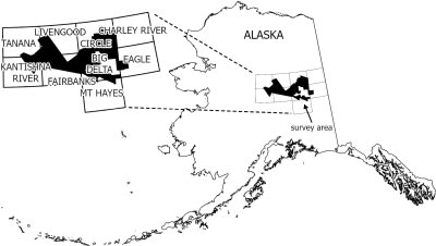
Quadrangle(s): Big Delta; Charley River; Circle; Eagle; Fairbanks; Kantishna River; Livengood; Mount Hayes; Tanana

Related project(s): Tanana River and Big Delta geophysics

Citation ID: 30899

Report Information

gpr2022_001.pdf (30.8 M)

Digital Geospatial Data

Tanana River and Big Delta geophysical survey Data File Format File Size Info
Download gpr2022_001_tanana-big-delta-ascii-data ASCII tabular files 4.4 G Metadata - Read me
Download gpr2022_001_tanana-big-delta-databases-geosoft Linedata Geosoft format database 4.7 G Metadata - Read me
Download gpr2022_001_tanana-big-delta-documents Adobe PDF files 4.1 M Metadata - Read me
Download gpr2022_001_tanana-big-delta-grids-ermapper Gridded data ER Mapper 176.8 M Metadata - Read me
Download gpr2022_001_tanana-big-delta-grids-geosoft Gridded data Geosoft format 177.2 M Metadata - Read me
Download gpr2022_001_tanana-big-delta-images-registered Georeferenced raster files 191.5 M Metadata - Read me
Download gpr2022_001_tanana-big-delta-kmz Google Earth files 615.9 M Metadata - Read me
Download gpr2022_001_tanana-big-delta-maps-geosoft Gridded data Geosoft format 566.1 M Metadata - Read me
Download gpr2022_001_tanana-big-delta-maps-pdf ASCII tabular files 2.3 G Metadata - Read me
Download gpr2022_001_tanana-big-delta-vector-data Shapefile 1.5 M Metadata - Read me

0 comments

Post a Comment

Experienced production quality results and superior client relationships.