About Us › Capabilities
Geophysical Survey Equipment Capabilities
A variety of survey equipment is available at MPX which can be custom configured to optimize your project needs.
Experienced professionals are available to assist you when selecting and planning your survey.

Equipment
- The latest in Geophysical Survey Acquisition Systems
- RMS – DAARC500 DAS
- The latest in Geophysical Survey Acquisition Systems
- Radiation Solutions RSX-5 Gamma Ray Spectrometers
- Scintrex CS3 and Geometrics G822A caesium magnetometers installed as single sensor or horizontal or vertical gradiometer configurations
- CMG GT 2A – Leading Edge Airborne Gravity Meters
- GSM 19 Base Station Overhauser Magnetometers with on-board GPS for post-processing
- Novatel & Hemisphere Dual Frequency GPS Receivers
- Radar & Laser Altimeters
- LiDAR – Aerial Mapping System
Technology
X-MAG Airborne Magnetometry
X-MAG enables precise exploration of magnetic signatures for various applications. From prospecting magnetic ores and geological mapping of lithological and structural features, to depth to basement mapping for hydrocarbon exploration and non-metallic mineral detection, X-MAG delivers valuable insights. It also aids in engineering projects, groundwater studies, and hazard assessments
X-RAD Airborne Radiometrics
X-RAD technology has revolutionized the exploration of radiometric signatures. It plays a crucial role in prospecting economic minerals such as uranium and porphyry copper deposits, as well as detecting uranium at the surface and exploring for gold using the Au-U association. X-RAD also aids in geological mapping for lithologic analysis and supports engineering studies, including monitoring radioactive leakage from nuclear power plants.
X-GRAVAirborne Gravity
X-TDEM Time Domain Electromagentics
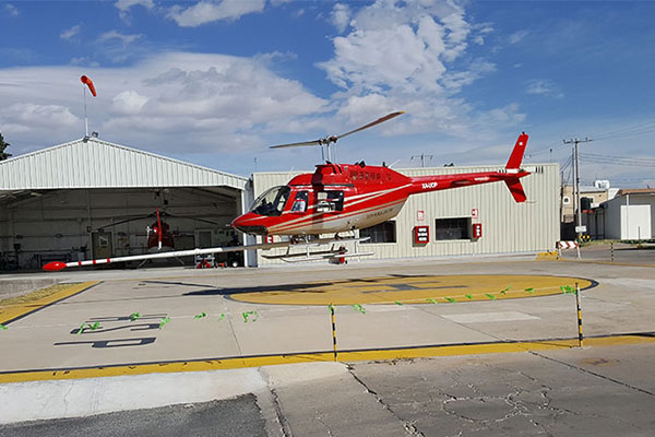
The X-TDEM system is designed for high spatial resolution, near-surface surveys using a lightweight helicopter with the versatility to work in rough terrain. This versatile helicopter system features a powerful compact transmitter, a 3-axis receiver and digital data acquisition & system control.
X-LIDARAirborne Lidar
Our advanced airborne lidar technology revolutionizes project planning, design, and engineering across multiple industries. With exceptional accuracy, X-LIDAR offers comprehensive cartography and topographical services for engineering applications such as roads, mass transportation, electrical projects, telecommunications, water management, flood control, forestry, and more. In mining and petroleum, X-LIDAR aids in pipeline mapping, resource management, volumetric calculations, drill location identification, and seismic acquisition.
MobileMT Mobile MagnetoTellurics
MobileMT, is patent pending technology that utilizes naturally occurring EM fields associated with lightning discharges. Thunderstorms release energy, some of which is converted into electromagnetic fields that propagate through the ionosphere-Earth interspace. The EM fields and currents induced by these fields in the subsurface are used in MobileMT to identify variations in subsurface electrical resistivity.